-
Belgium: Rivers and catchments
The students in the first part discover the river basins. They have to rank them according to size. The students then study the rivers on the map of Belgium. On an outline map on the smartboard they move up the name of every river in the right …
Translated by
 Downloadable resource (16)Schoolboard
 -
Population, wealth and prosperity in the world: Differentiation

This document includes:
- A general assignment
- 3 versions of the questionnaire. The questions on this questionnaire are the same every time but you just have version A questionnaire, to B students get a little bit tips and C students get tips …
Translated by
Downloadable resource (14)Teacher, Learning mentor, … -
Working with maps: Corner Work

Using this contribution, the students learn to work with maps.
The students go to class n work with different cards (maps, but GPS map and directions).Translated by
Downloadable resource (25)Teacher -
Working with the atlas: Repetition

The worksheets will be discussed the following:
- Map study: Belgium (towns, rivers, language, communities and regions);
- Map study: countries of Europe;
- Map study: the world's oceans +;
- theory: scale, legend, index.
Translated by
Downloadable resource (96)Teacher -
Maps of Belgium

In this Turning Technologies Workspace file you will find different maps of Belgium. You can use these cards to make a lesson, have students practice or let students explore cards independently.
Translated by
Downloadable resource (12)School/education -
Monsoon Asia: Rice
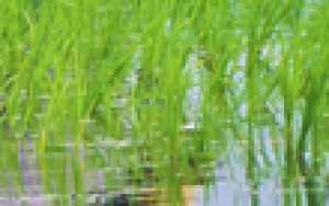
This three-page task is intended as a fixation in the DVD Rice Cultivation in Monsoon Asia , which also includes a contribution to KlasCement . There you will also find a short video that already gives a picture of what can be seen on the DVD.
Translated by
Downloadable resource (5)Teacher -
Ecological footprint and food footprint

The course contains theory about the ecological footprint and the food footprint. As instructed, some links to web addresses where the pupil can go calculate yourself how big are food and ecological footprint.
The theory is applied by means of a …
Translated by
Downloadable resource (36)Teacher -
Fracture and stroke scale: Key
 These issues surrounding the calculation of distances between cities, must be resolved with the breaking scale and line scale. The students formulate answers in a sentence.
Translated by
Downloadable resource (45)Teacher -
France: Landscape, climate, attractions, ...

Fill a text about France:
- General facts (capital, population, national anthem ,...)
- Landscape
- Climate
- Sights: the Louvre, the Eiffel Tower, Centre Pompidou, Notre Dame, Sacre Coeur, the Arc De TriompheTranslated by
Downloadable resource (36)Teacher -
Belgium: Grondsoorten
 A simple task that allows students to paint according to the Belgian soil types.
Translated by
Downloadable resource (13)Teacher -
Belgium: Relief
 A simple task of relif of Belgium to share. Based on 3 zones and a format that only applies to our country.
Translated by
Downloadable resource (16)Teacher -
China: Atlas Exercises

Students go their atlas to find the neighbors of China (host of the Olympic Games 2008). They indicate that countries on a map and find the capital of each country.
Translated by
Downloadable resource (5)Teacher
Yummmm… cookies!
We don't like being tracked either. That's why we're concerned about your privacy.
Necessary cookies: for the proper operation of the website.
Functional cookies: for your convenience. recommended
Social media cookies: to view embedded media such as videos from YouTube, Facebook … recommended
Statistical cookies: for anonymous data collection to enhance user experience.